A Severe Thunderstorm Warning Is Not a Forecast for Every Street
Rain, hail and flash flooding can strike unevenly. Understanding the difference between an outlook, warning and observed storm is useful across Sydney and NSW.
 Harbour Creative Team
2 min read
Harbour Creative Team2 min read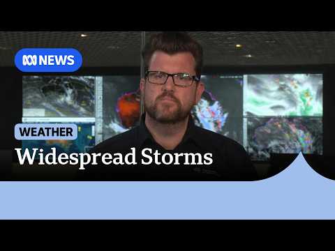
Why a warning does not mean everyone will be hit
Severe thunderstorms were forecast over parts of south-east Queensland and northern NSW during the November weekend, with forecasters highlighting the possibility of damaging winds, heavy rainfall and flash flooding. ABC News carried advice from senior Bureau meteorologist Dean Narramore as storm cells developed.
A regional warning describes a hazard in an area, not an assertion that every suburb will have hail or flooding. Individual cells form, move and weaken. Someone may experience torrential rain while a few kilometres away the weather remains relatively quiet. That variation is why timestamps and updated warning polygons matter.
What the language means
An outlook signals atmospheric conditions that could support severe weather. A warning indicates a more specific threat and should be read with the official location and time. An observed impact is different again: it means damage, rainfall or another event has actually been recorded.
For a household, these distinctions affect decisions. A forecast should prompt planning; a warning for the immediate area may require prompt action; reports of flooded roads should change the route taken. None should be treated as a guarantee that the same conditions will persist all afternoon.
A practical approach for residents
Check the latest Bureau warnings before outdoor activities, look at current transport and road advice, and avoid driving into floodwater. Secure loose items when damaging winds are plausible, but do not rely on a single screenshot of an old forecast.
In Sydney, conditions also vary between coastal and western suburbs. Our local guides can help with service information, but they are not a substitute for current emergency alerts. The accompanying video is the forecaster's November briefing, not live footage of conditions today.
Watch the original report
The video above was published by ABC News (Australia) on 13 November 2026. It is included as source material for this independent analysis; it is not footage produced or filmed by Harbour Creative Blogs. View the broadcaster's original reporting.
About this article
This article provides analysis and interpretation of available information. Sources and supporting material, where applicable, are linked within the article.
Found an error? Contact the editorial desk. See our editorial standards and corrections policy.
From the Harbour Creative Blogs archive
Keep exploring this story
Related reporting, people and places from our published coverage. These are editorial connections, not a popularity ranking.
Local coverage
Sydney
The business, communities, housing, transport, sport and public decisions affecting metropolitan Sydney.
Local coverage
Newcastle
The harbour, energy exports, regional economy and communities of Newcastle.
Subject
Weather forecasting
Observation systems, forecasting science and severe weather information.